
Wild weather on east coast a sign of what's to come this summer

Heavy rain and storms that will continue to lash Australia’s east coast this week will give an indication of the severe weather that will be seen over the summer months.
The low pressure system that moved in on Friday brought damaging 70km/h winds, constant rainfall to NSW and hail to Queensland over the weekend, Weatherzone Meteorologist Esteban Abellan told Yahoo News Australia.
While the worst of it has passed, the states will continue to see wild weather throughout the week - and possibly more hail.
The Bureau of Meteorology issued a severe weather warning on Monday for Newcastle, Gosford, Maitland, The Entrance, Woy Woy and Kulnura.

Residents have been told to watch out for winds reaching peaks of up to 90km/h and flash flooding, which are expected to ease in the afternoon.
Lismore, Grafton, Casino and Yamba have also been issued with a severe thunderstorm warning as large hailstones are expected throughout the day.
Heavy rainfall in Sydney has caused a landslide on the city's Northern Beaches, according to Nine News.
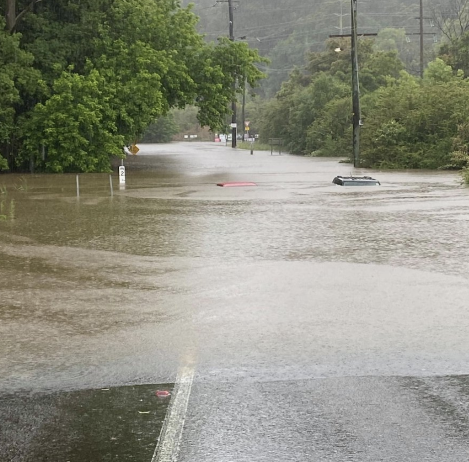
Residents of 15 homes were evacuated after at least three properties were damaged.
Fast ferries between Sydney and Manly have been cancelled due to the swell in Sydney Harbour, with buses replacing surfaces. The large regular ferries were said to have been seen rocking in the surf.
Temperatures on Monday will stay well below average, with Sydney sitting at 13 degrees around 6.30am - five degrees less than average.
Canberra will also see a high of 12 degrees - nine degrees less than its average for October.
The biggest rainfall in NSW over the weekend was in Gosford and Newcastle, which saw more than 100mm in less than 24 hours, Mr Abellan said.
Orange, in central NSW, saw 66mm of rain from Friday night to Monday morning.
Showers will continue across central and eastern NSW on Monday and Tuesday.
Storms are predicted to form near the state’s border with Queensland on Tuesday and Wednesday, bringing more lightning and possibly hail.
Queensland lashed with hail ‘size of golf balls’
Large hailstones, some reportedly the size of golf balls, damaging winds and heavy rain lashed Queensland on Sunday afternoon.
A man in his 30s was struck in the head by a falling tree and more than 30,000 homes lost power.
alee property, west of Brisbane, about 1pm.
The man is in a stable condition at Princess Alexandra Hospital after suffering upper body injuries around 1pm.
Power supplier Energex recorded more than 80,000 lightning strikes in the southeast from midday to 4pm.
Shocking video footage has captured the moment a lightening strike split a tree in half as shocked residents looked on.
High winds and flying debris brought down 207 powerlines, with significant damage to networks in the Redland Bay, Mt Crosby and Bay Islands.
Some people in those areas may not have power restored until Monday, Energy Queensland said
More than 30,000 homes were without power at 3pm, although about 5000 had been reconnected to the grid by Sunday evening.

La Nina to bring cyclones and flooding
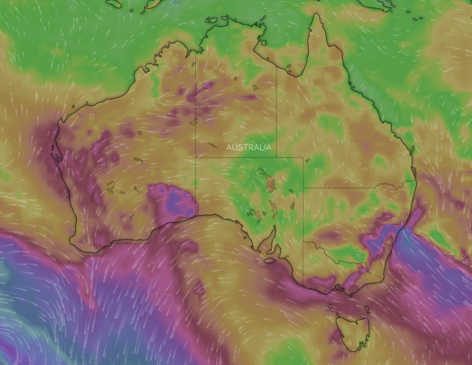
Australia is likely to be hit with increased severe weather over the next six months with more cyclones and flooding forecast.
The current La Nina may also bring drought-easing rain to some areas, with this year's northern wet season expected to arrive early, the Bureau of Meteorology said.
Climatologist Greg Browning said the La Nina was also likely to result in a rise in the number of cyclones forming between October and April.
"On average Australia sees nine to 11 tropical cyclones each year, with four crossing the coast," he said.
"With La Nina this year we are expecting to see slightly more tropical cyclones than average."
Bureau modelling suggests there's an increased risk of widespread flooding in Queensland, NSW, Victoria, Tasmania and northern Western Australia.
It's been another week of interesting weather around Australia. 😌 @tophertrick (IG) captured the rainy scenes in the Red Centre on Monday - did you see the waterfalls flowing down the sides of #Uluru? pic.twitter.com/8Ew144JXHC
— Weatherzone (@weatherzone) October 25, 2020
Higher-than-average rainfall is also predicted across much of the country, which is likely to increase humidity levels.
This could result in fewer severe heatwaves and extreme heat days in southern areas but they may last longer and be more sticky.
More rain also means there's also likely to be fewer catastrophic blazes this bushfire season.
Australia has been slammed with an extended period of below-average rainfall in many areas since early 2017, with numerous parts of the country enduring years of prolonged drought.
Southern Queensland and inland NSW are among the most severely affected regions, although recent heavy rainfall has brought relief to some areas.
with AAP
Do you have a story tip? Email: newsroomau@yahoonews.com.
You can also follow us on Facebook, Instagram and Twitter and download the Yahoo News app from the App Store or Google Play.


